Sign up
You have successfully registered, a confirmation email has been sent to the email address you provided.

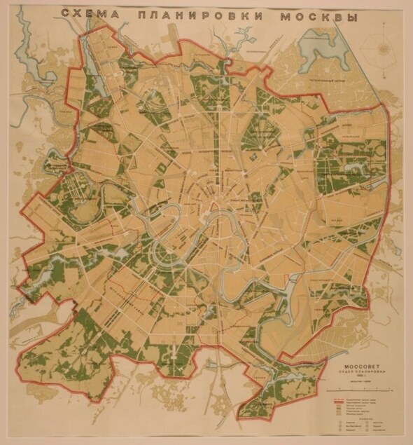
This colour scheme, published in 1935 by the Planning Department of the Mossovet, shows Moscow within its projected boundaries. At the top is the title "Skhema planirovki Moskvy" ("Planning Scheme of Moscow"), in the upper right corner a wind rose, and at the lower right a scale bar and a legend. A red line outlines the city boundary, areas of greenery are marked in green, and the label "Novaya magistral" ("New Thoroughfare") appears repeatedly on the streets.
The scheme came out in the year the General Plan for the Reconstruction of Moscow was approved: the resolution of the Central Committee of the VKP(b) and the Council of People's Commissars of the USSR is dated 10 July 1935. Developed under the direction of the architects Vladimir Semyonov and Sergei Chernyshev, the plan preserved the city's established radial-ring structure and supplemented it with new thoroughfares, which were to be widened to 30–40 metres. Moscow's territory was to grow from 285 to 600 km², the population was limited to 5 million, and a forest-park belt was to be created within a radius of 10 km of the new boundaries. The south-west was designated as the main direction for expanding development.
According to the Museum of Moscow's online collection, the scheme was issued in a print run of 50,000 copies. The reconstruction of the capital under the 1935 General Plan soon became the main theme of the museum's own exhibition.
